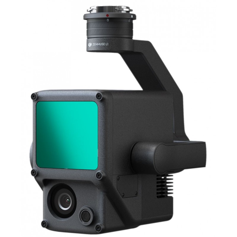
In the ever-evolving world of aerial surveying and mapping, the combination of the DJI Zenmuse L1 and the DJI Terra Lifetime License continues to stand out as a formidable choice for professionals in the field. Although this powerful duo isn’t new to the market, its significance has only grown as more industries recognize the importance of precise data collection and analysis.
The DJI Zenmuse L1 integrates a high-performance LiDAR module with a 20 MP RGB camera, enabling users to capture detailed, geo-referenced data in a variety of conditions. With its operational flexibility, it excels in diverse environments, from dense forest canopy to urban landscapes, making it indispensable for land surveying, agricultural assessment, and infrastructure management. Surveyors are particularly drawn to its Real-Time Kinematic (RTK) functionality, which ensures geospatial accuracy with minimal post-processing time.
On the software side, the DJI Terra Lifetime License offers users a robust tool for processing the data collected by the Zenmuse L1. The software is designed to support mapping, modeling, and analyzing 3D data efficiently. With the lifetime license, users can benefit from ongoing software updates and access to new features without the worry of recurring costs—a crucial factor for many businesses aiming to manage their budgets while maintaining cutting-edge capabilities.
As industries adapt to the increasing complexity of projects, the synergy between the Zenmuse L1 and DJI Terra has proven to be a cost-effective solution that enhances workflow efficiency. Now more than ever, businesses are looking for solutions that not only offer high-quality outputs but also reduce project turnaround times. The ease of use of DJI Terra, combined with the rapid data capture capabilities of the Zenmuse L1, allows teams to deliver results faster and with greater accuracy.
Furthermore, as environmental concerns escalate, the application of the Zenmuse L1’s LiDAR technology becomes increasingly relevant. It facilitates enriched data collection for environmental monitoring and conservation efforts, allowing organizations to monitor changes in land use or perform ecological assessments with exceptional precision.
In recent developments, several case studies have emerged showcasing successful projects utilizing this technology, further validating its position in the market. Collectively, these success stories highlight the transformative impact of the Zenmuse L1 and DJI Terra suite, benefiting a range of sectors including construction, agriculture, and environmental science.
As professionals continue to embrace aerial technology for surveying and data management needs, the DJI Zenmuse L1, paired with the DJI Terra Lifetime License, remains a leading choice that combines innovation, reliability, and efficiency. It’s clear that this powerhouse combination isn’t just relevant for aerial solutions now; its long-term potential is being recognized across various industries, solidifying its legacy in the world of drone technology and data analytics.
Buy DJI Zenmuse L1 + DJI Terra Lifetime License at ts2.store!
Maximize Your DJI Zenmuse L1 with DJI Terra: User Tips and Interesting Facts
The DJI Zenmuse L1 is an innovative LiDAR payload designed for the Matrice 300 RTK drone, enabling users to capture high-precision 3D data. When paired with DJI Terra, a powerful mapping software, it transforms how professionals in various industries approach surveying, mapping, and vegetation analysis. Here are some valuable tips and intriguing facts to enhance your experience with the Zenmuse L1 and the DJI Terra Lifetime License.
User Tips for DJI Zenmuse L1
1. Calibration is Key: Before every flight, ensure that your Zenmuse L1 is calibrated correctly. This enhances accuracy and consistency in your LiDAR data collection.
2. Choose the Right Flight Settings: Depending on the terrain and the project requirements, adjust your flight altitude and speed. Lower altitudes provide more detail, while higher altitudes cover larger areas quicker.
3. Utilize the Integrations: Take full advantage of the integration between the Zenmuse L1 and the Matrice 300 RTK to perform intelligent obstacle avoidance, ensuring safer flights and better data collection.
4. Plan Your Flight Paths: Before taking to the skies, pre-plan your flight routes in DJI Terra to ensure comprehensive coverage and efficient data capture. This can significantly reduce the time spent in the field.
5. Post-Flight Data Processing: After your flight, use DJI Terra to process your collected LiDAR data. The software allows you to create high-quality 3D models and maps that can aid in your analysis.
Interesting Facts About DJI Zenmuse L1
– Dual Payload Capabilities: The Zenmuse L1 combines a laser scanner and a high-resolution RGB camera, allowing for simultaneous data collection from the same flight, which saves time and enhances project efficiency.
– Real-Time Data Streaming: It supports real-time data streaming to assist with immediate on-site analysis. This feature can be crucial for industries such as construction and disaster management.
– Range and Accuracy: The Zenmuse L1 can reach a maximum range of 450 meters and boasts an accuracy of ±5 cm, making it one of the most efficient LiDAR sensors available for drone applications.
– LiDAR and Photogrammetry Fusion: Users can combine LiDAR point clouds and photogrammetry data to create comprehensive models that capture both topographic details and color information, providing a complete view of the surveyed area.
Benefits of the DJI Terra Lifetime License
– Cost-Efficiency: With a lifetime license, you make a one-time investment for continuous access to DJI Terra’s powerful features without worrying about recurring fees.
– Always Up-to-Date: The lifetime license includes updates and new feature releases, ensuring you always have the latest tools and capabilities at your disposal.
– Enhanced Collaboration: The software allows for multi-user collaboration, making it perfect for teams working on large projects. Share maps, data, and edits seamlessly among team members.
– User-Friendly Interface: DJI Terra is designed with usability in mind, so even beginners can navigate its extensive features without a steep learning curve.
To dive deeper into the world of drone mapping and improve your skills, check out the official DJI resources at DJI for more information on products and updates related to the Zenmuse L1 and DJI Terra.
With the right knowledge and tools, you can significantly enhance your data collection and analysis capabilities with the DJI Zenmuse L1 and DJI Terra. Embrace this innovative technology and take your projects to new heights!
Visit DJI Zenmuse L1 + DJI Terra Lifetime License for more about the product and great deals!


